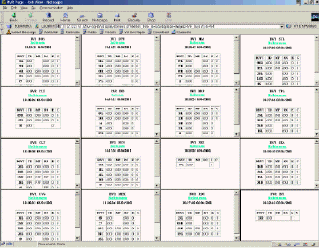
The FAA is now providing real-time Runway Visual Range (RVR) data to FAA facilities and air carriers. The RVR system at an airport reports RVR values from 0 to 6500 feet that, roughly speaking, represent the distance that a pilot is able to see down the runway. For a fully instrumented runway, RVR values are given for the touchdown, midpoint, and rollout portions of the runway, along with an indication of whether the values are increasing, decreasing, or stationary; in addition, the status of edge and centerline lights is given. Every two seconds, an RVR value is reported that is an average of the values over the last minute.
Public RVR site http://rvr.fly.faa.gov